- Printed on Regular Paper (32lb)
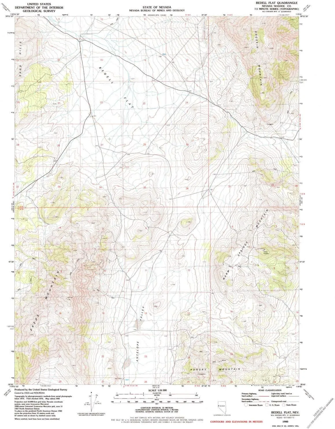
- USGS topographic map of Bedell Flat, NV, at 1:24000 scale. High-quality paper print. Perfect for wall maps.
- Cities, towns, villages: Nashville
- Rivers, creeks: See preview to find streams near Bedell Flat
- Lakes: Dry Lake
USGS topographic map of Bedell Flat, Nevada, dated 1980, updated 1984.
Includes geographic coordinates (latitude and longitude), lines of elevation, bodies of water, roads, and more. This topo quad is suitable for recreational, outdoor uses, office applications, or wall map framing.
Printed on-demand by YellowMaps on the print material of your choice.
Shipping rolled from Minneapolis, MN, United States.
Product Number: USGS-5566884
Map Size: 26.8 inches high x 22 inches wide
Map Scale: 1:24000
Map Type: POD USGS Topographic Map
Map Series: HTMC
Map Version: Historical
Cell ID: 2999
Scan ID: 318084
Imprint Year: 1984
Woodland Tint: Yes
Aerial Photo Year: 1975
Edit Year: 1980
Field Check Year: 1976
Datum: NAD27
Map Projection: Transverse Mercator
Map published by United States Geological Survey
Map Language: English
Scanner Resolution: 600 dpi
Map Cell Name: Bedell Flat
Grid size: 7.5 X 7.5 Minute
Date on map: 1980
Geographical region: Nevada, United States
Northern map edge Latitude: 39.875°
Southern map edge Latitude: 39.75°
Western map edge Longitude: -119.875°
Eastern map edge Longitude: -119.75°
Surrounding map sheets (copy & paste the Product No. in the search bar):
North:
East: USGS-5573244,USGS-5568304,USGS-5568302,USGS-5568300
South: USGS-5570544,USGS-5570548,USGS-5570546
West: USGS-5568530,USGS-5568532


